Stations
Pick a point you can see from the last one
A station is any spot with a clear line to the previous station: a rock knob, a mark on the wall, a spot on the floor. It doesn't have to be marked forever, but every reading starts and ends there.
METHODHow a survey is made
A survey team of two or three repeats the same few steps for every leg, often a hundred times a trip. Here is one leg, start to finish, with the readings from a real plot.
Stations
A station is any spot with a clear line to the previous station: a rock knob, a mark on the wall, a spot on the floor. It doesn't have to be marked forever, but every reading starts and ends there.
The shot
From one station to the next you take three readings: the distance, the bearing from north and the angle up or down. A DistoX takes all three in one laser shot.
LRUD
At each station, the distance left, right, up and down. Four numbers give the passage its width and height.
The sketch
The sketcher draws walls, boulders, water and sand in pencil around the station line, on waterproof paper or a tablet.
Back-sight
Reading the leg from the far end should give the bearing ±180° and the same angle with the opposite sign. If not, someone redoes it.
Plot and close
Back on the surface the readings become coordinates. Where the survey loops back on itself, the gap between start and finish is the error.
S.02The notebook
This is what arrives on our desk: a table of legs and a sketch around them. These twelve legs are the start of the cave on the home page.
| From | To | Tape m | Comp ° | Clino ° | L | R | U | D |
|---|
S.03British Cave Research Association
The BCRA scale dates from the 1960s. A grade has two parts: a number for the survey line and a letter for the passage detail. Most of our work is 5C or 5D.
| 1 | A sketch, no measurements. |
|---|---|
| 2 | Between 1 and 3. Use only if necessary. |
| 3 | Rough magnetic survey. Angles ±2.5°, distances ±50 cm, stations within 50 cm. |
| 4 | Better than 3, short of 5. Use only if necessary. |
| 5 | Magnetic survey. Angles ±1°, distances to the nearest centimetre, stations within 10 cm. Calibrated instruments; coordinates calculated. |
| 6 | Compass and clino to ±0.5°, stations within 2.5 cm, on tripods or roof hooks. |
| X | Theodolite or total station. The drawing must say what was used. |
| A | From memory. |
|---|---|
| B | Estimated and noted in the cave. |
| C | Measured at the stations only. |
| D | Measured at the stations and wherever the passage changes. |
Summary of the BCRA tables; the full definitions have notes that go with them. Normal pairs: 1A, 3B or 3C, 5C or 5D, 6D, XA to XD.
S.04Instruments
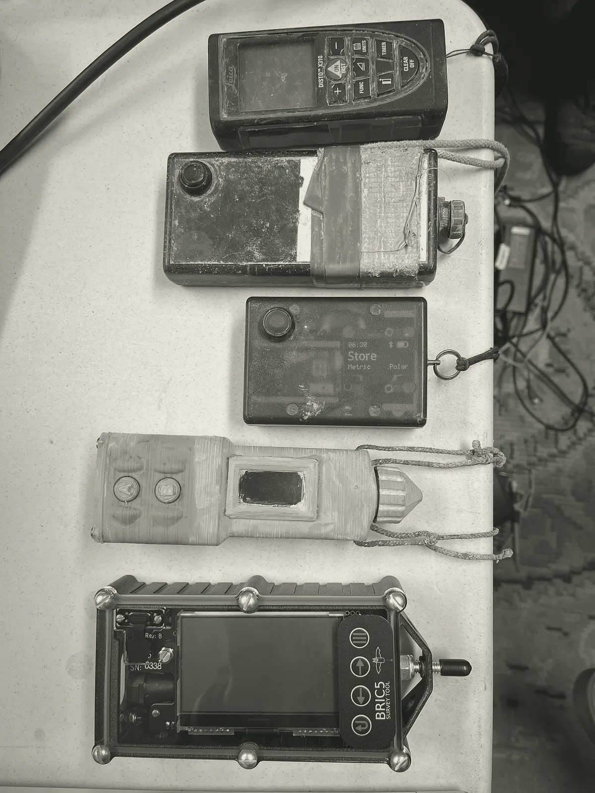
Since around 2007 most British teams survey paperless: a laser rangefinder with a compass and clinometer built in, talking to a tablet that draws the line as you go. The first, the DistoX, was a commercial rangefinder a Swiss caver rebuilt. Cavers have built others since, like the SAP and the BRIC.
We take data from any of them, and from tape and compass too.
S.05Questions
Usually. Send scans of every page, including the crossed-out ones. If a leg is missing or a reading doesn't fit, we flag it in the closure report rather than guess.
Both. The centreline is reduced and loop-closed in Survex; the drawing is done in Therion or by hand, depending on the cave and what the club wants to edit later.
For a careful grade 5 survey, a misclosure well under 1% of the loop's length. A large error in one loop often comes from a single misread leg, which we can usually find.
You do. In the UK cave surveys are usually published freely, and we encourage it; we only ask to be credited as the draughtsman.