Cave surveys, drawn to grade.
* BACKSIGHT turns your club's survey notes (tape, compass, clino, LRUD and the sketches) into finished plans, elevations and sections. A drawing office in Clapham, under Ingleborough.
S.01What a survey is
Every line on a cave survey starts as three numbers: a distance, a bearing and an angle.
Measured from station to station, from the entrance to the last place a person fitted. We turn those numbers into a drawing you can navigate, publish and argue about.
S.02Seen from above
01The plan
The plan is the cave seen from above: walls, floor detail, pitches, water and the station line, on a 20 m grid with true north.
- Passage wall
- Survey line and stations
- Pitch, with its depth
- Stream and sump
- Boulders, sand, pebbles
Need a plan for a new extension? Send the data →
S.03Seen side-on
02The elevation
The elevation is the same cave turned on its side, so depth reads at a glance. ±0 m is the entrance, the datum every height is measured from.
- Depth
- 0 m
- Surveyed length
- …
- Pitches
- …
- Stations
- …
S.04Cut across
03The sections
A section is the passage cut across, drawn wherever the shape changes. The shape tells you how the passage formed: water under pressure makes round tubes, a free-flowing stream cuts down into a slot.
- Phreatic tubeDissolved full of water, all round
- KeyholeA tube, then a stream cut a slot below
- RiftTall and narrow, along a joint
- CanyonA trench with water in its floor
- Bedding planeWide, low, along the rock layers
- ChamberDomed roof, floor of fallen blocks
S.05How exact
Drawn to grade
British surveys carry a BCRA grade. It says how carefully every reading was taken. The plot on the right is one loop of this cave, re-surveyed at each grade's tolerances: pick one and watch how far the loop misses its own start.
Grade 5
A magnetic survey: angles to ±1°, distances to the nearest centimetre, stations fixed to within 10 cm. Coordinates are calculated, never drawn with a protractor.
- Loop length
- …
- Misclosure
- …
- Error
- …
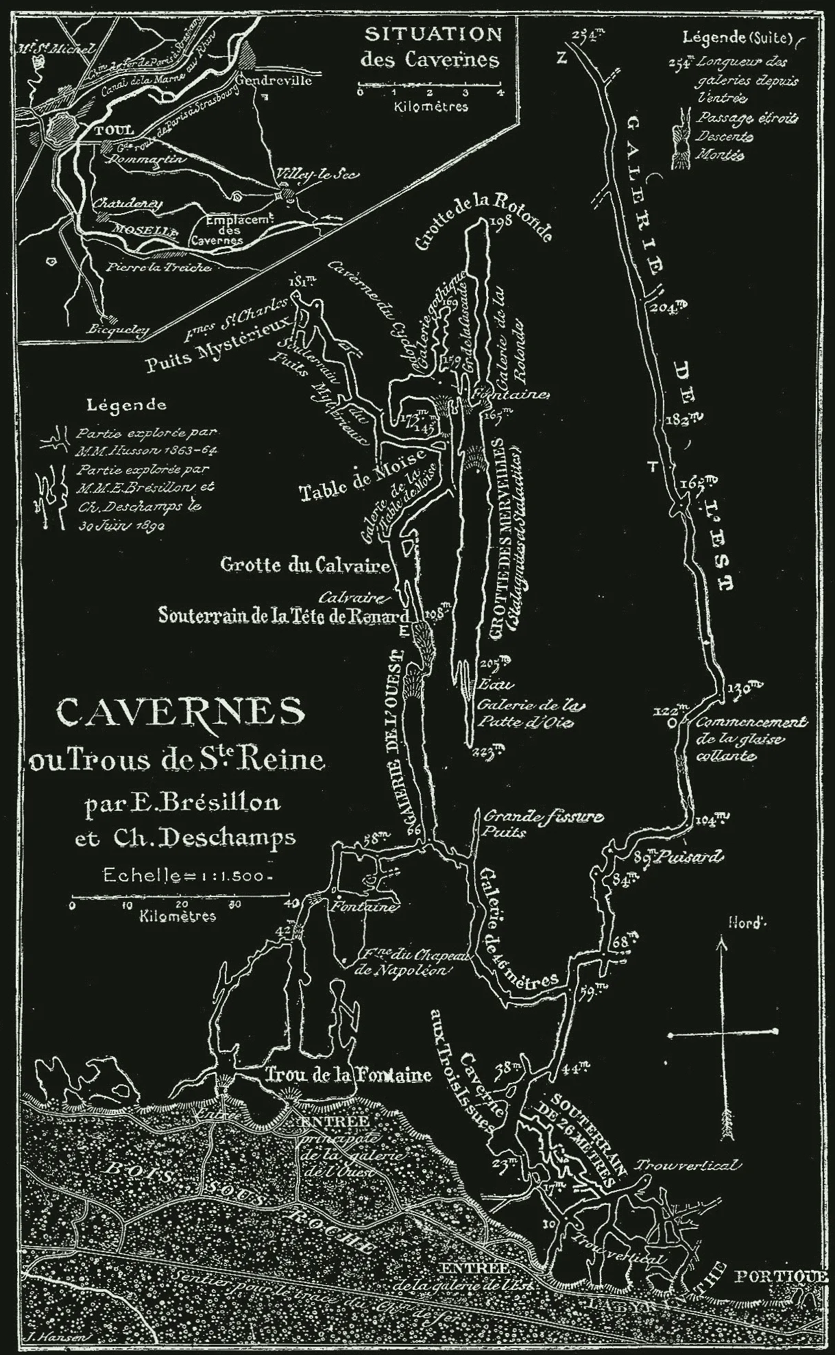 Grotte Sainte-Reine, plan by Brésillon and Deschamps, published by Martel in Les Abîmes, 1894
S.06The method
250 years, smaller instruments
Cave surveying has barely changed since the 1760s: line-of-sight legs between stations, one after another. Martel, who made the first complete descent of Gaping Gill in 1895, paced towards an assistant's lamp and took a bearing on it. Today that counts as grade 2.
- 1546First known plan of a cave: Nero's Oven, a man-made cavern at Pozzuoli
- 1656First natural cave mapped, the Baumannshöhle in Germany
- 1680John Aubrey draws Long Hole, Cheddar, side-on
- 1765Grotte de Miremont, the first cave surveyed with instruments
- 1895Martel reaches the floor of Gaping Gill, 98 m down
- 1964First centreline plotted by computer, Fergus River Cave
- 1992Survex, written by Cambridge cavers, released to everyone
- 2007Fully paperless surveying, with laser instruments like the DistoX